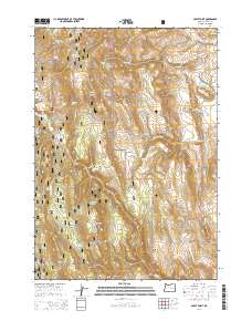
2014 Map of Craft Point
USGS Topo · Published 2014About this map
Malhuer National Forest encompasses much of this high-elevation landscape in Harney County, characterized by a series of prominent peaks and vital water sources. The map highlights significant topographical landmarks such as Mountain Tom, Buck Butte, and Elephant Butte, which dominate the central and southern portions of the quadrangle. Cattle ranching and water management are evident through the naming of localized features like Dietrich Ranch Rd and several man-made catchments, including Miller Reservoir, Poer Reservoir, and Temple Reservoir. Numerous springs, such as Jordan Spring, Ralphs Spring, and Widow Spring, are scattered across the terrain, indicating the importance of these water points in a relatively arid environment. To the south, Craft Point and Thompson Mountain overlook Oard Flat, while the historical path of the Fort Harney N Rd traces the western edge, connecting this remote area to regional frontier history.
Find a feature on this map
38 named features on this map. Tap any name to fly to it.
Don’t see what you’re looking for? This feature index may not catch every label — zoom into the map to look around manually.
Map Details
Editions of this 2014 Craft Point Map
This is the sole edition of this map. No revisions or reprints were ever made.
Other maps of this area

1955 · Burns
USGS Topo · 1:250,000

1958 · Burns
USGS Topo · 1:250,000

1959 · Burns
USGS Topo · 1:250,000

1959 · Harney
USGS Topo · 1:62,500

1961 · Calamity Butte
USGS Topo · 1:62,500

1968 · Van
USGS Topo · 1:62,500

1973 · Buchanan
USGS Topo · 1:24,000
1978 · Stinkingwater Pass
USGS Topo · 1:24,000

1978 · Stinkingwater Mountains
USGS Topo · 1:100,000
1990 · Calamity Butte
USGS Topo · 1:24,000