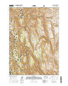
2017 Map of Craft Point
USGS Topo · Published 2017About this map
Malheur National Forest dominates this high-desert landscape in Harney County, where ranching infrastructure and mountain peaks define the terrain. The presence of the historic Fort Harney Mil Rd highlights the era of military and pioneer transit across eastern Oregon, connecting these remote slopes to wider regional history. Water sources are critical in this environment, evidenced by named springs like Jordan Spring and Thompson Spring, alongside man-made water management features such as Poer Reservoir and Miller Reservoir. The map reveals a network of land management and access, including the Dietrich Ranch Rd and Craft Spring Rd, which provide passage through the varied elevations of Elephant Butte and Thompson Mtn. This document serves as a detailed record of high-country resources and the historic routes used to navigate the Oard Flat area.
Find a feature on this map
43 named features on this map. Tap any name to fly to it.
Don’t see what you’re looking for? This feature index may not catch every label — zoom into the map to look around manually.
Map Details
Editions of this 2017 Craft Point Map
This is the sole edition of this map. No revisions or reprints were ever made.
Other maps of this area

1955 · Burns
USGS Topo · 1:250,000

1958 · Burns
USGS Topo · 1:250,000

1959 · Burns
USGS Topo · 1:250,000

1959 · Harney
USGS Topo · 1:62,500

1961 · Calamity Butte
USGS Topo · 1:62,500

1968 · Van
USGS Topo · 1:62,500

1973 · Buchanan
USGS Topo · 1:24,000
1978 · Stinkingwater Pass
USGS Topo · 1:24,000

1978 · Stinkingwater Mountains
USGS Topo · 1:100,000
1990 · Calamity Butte
USGS Topo · 1:24,000