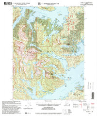
1997 Map of Craig A-1
USGS Topo · Published 2000About this map
Cholmondeley Sound and Moira Sound carve deep into the southeastern coastline of Prince of Wales Island, defining a landscape of narrow inlets and isolated maritime settlements. This late-twentieth-century revision reveals the state of remote outposts and industry within the Tongass National Forest, specifically noting the status of formerly active locations like Chomly and Dolomite. The rugged geography is dominated by Eudora Mountain and Dolomite Mountain, with access to the interior provided by routes such as National Forest Trail 384. From the Logging Camp at Johnson Port to the Kegan Cove Cabin, the map documents a transitional period for the region's wilderness management and maritime commerce. Named features like Niblack Anchorage and Dickman Bay emphasize the critical importance of sheltered water for navigation in this complex archipelago.
Find a feature on this map
50 named features on this map. Tap any name to fly to it.
Don’t see what you’re looking for? This feature index may not catch every label — zoom into the map to look around manually.
Map Details
Editions of this 1997 Craig A-1 Map
This is the sole edition of this map. No revisions or reprints were ever made.
Other maps of this area

1948 · Dixon Entrance D-2
USGS Topo · 1:63,360

1948 · Prince Rupert D-6
USGS Topo · 1:63,360

1948 · Ketchikan A-6
USGS Topo · 1:63,360

1948 · Craig A-1
USGS Topo · 1:63,360

1948 · Dixon Entrance D-1
USGS Topo · 1:63,360

1948 · Craig A-2
USGS Topo · 1:63,360

1949 · Craig B-2
USGS Topo · 1:63,360

1949 · Craig B-1
USGS Topo · 1:63,360

1950 · Craig B-1
USGS Topo · 1:63,360

1951 · Craig B-2
USGS Topo · 1:63,360