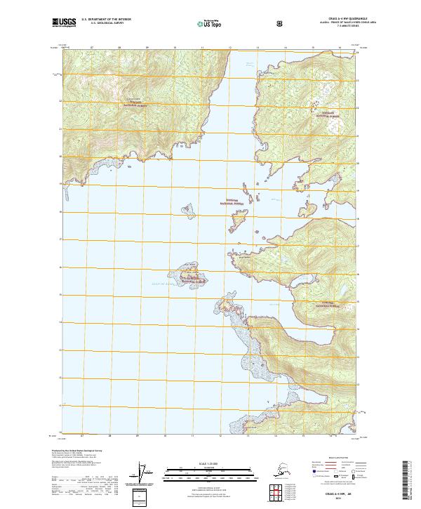
2021 Map of Craig A-4 NW
USGS Topo · Published 2021About this map
Suemez Island and the surrounding reaches of the Tongass National Forest define this coastal landscape on the Prince of Wales Archipelago. The map documents a complex maritime environment where the open Gulf of Alaska meets protected inner waterways. Navigation and coastal geography are the primary focus, with prominent landmarks such as Eagle Point and Juel Point marking the transition from the passage to more sheltered inlets. Deep indentations in the shoreline create features like Bobs Bay, Diver Bay, and the uniquely named Hole-in-the-Wall. The interior terrain is characterized by the dense timber and coastal peaks typical of southeast Alaska, while offshore hazards and small landmasses like the Diver Islands and Diver Rocks punctuate the Meares Passage.
Find a feature on this map
18 named features on this map. Tap any name to fly to it.
Don’t see what you’re looking for? This feature index may not catch every label — zoom into the map to look around manually.
Map Details
Editions of this 2021 Craig A-4 NW Map
This is the sole edition of this map. No revisions or reprints were ever made.
Other maps of this area

1948 · Craig A-4
USGS Topo · 1:63,360

1948 · Craig B-5
USGS Topo · 1:63,360

1948 · Craig A-5
USGS Topo · 1:63,360

1949 · Craig B-4
USGS Topo · 1:63,360

1951 · Craig B-4
USGS Topo · 1:63,360

1951 · Craig A-4
USGS Topo · 1:63,360

1957 · Craig
USGS Topo · 1:250,000
1994 · Craig A-4
USGS Topo · 1:63,360

2000 · Craig B-5
USGS Topo · 1:63,360
2017 · Craig A-5 NE
USGS Topo · 1:25,000