
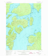
1948 Map of Craig B-5
USGS Topo · Published 1957About this map
The archipelago of the Tongass National Forest comes into focus through this detailed coastal survey, showing a network of islands and protected ports in the late 1940s. Named points of land such as Pt San Roque and Pt Bonifacio define the intricate coastline of Noyes Island and Lulu Island, separated by the St Nicholas Channel. A lone Mineral deposit sits near Port San Antonio, hinting at the geological interest of these islands beyond their value as naval harbors.
Find a feature on this map
79 named features on this map. Tap any name to fly to it.
Don’t see what you’re looking for? This feature index may not catch every label — zoom into the map to look around manually.
Map Details
Editions of this 1948 Craig B-5 Map
2 editions found
Other maps of this area

1948 · Craig A-4
USGS Topo · 1:63,360

1948 · Craig A-5
USGS Topo · 1:63,360

1948 · Craig B-6
USGS Topo · 1:63,360

1949 · Craig C-4
USGS Topo · 1:63,360

1949 · Craig B-4
USGS Topo · 1:63,360

1951 · Craig C-6
USGS Topo · 1:63,360

1951 · Craig B-4
USGS Topo · 1:63,360

1951 · Craig C-4
USGS Topo · 1:63,360

1951 · Craig C-5
USGS Topo · 1:63,360

1951 · Craig A-4
USGS Topo · 1:63,360