
1951 Map of Craig C-6
USGS Topo · Published 1952About this map
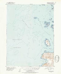
Noyes Island dominates the southeastern quadrant of this coastal survey, situated within the expansive Tongass National Forest. The landscape is defined by complex waterways and maritime hazards, from the wide expanse of Iphigenia Bay to the narrow Sonora Passage. Along the rugged coastline of Noyes Island, landmarks like Cape Ulitka, Ulitka Bay, and Roller Bay illustrate the intricate shoreline that characterizes the Alexander Archipelago. This 1951 field check preserves the coastal geography as it was recorded shortly after the war, showing the cluster of the Maurelle Islands and the Wood Islands to the north. Smaller features such as Timbered Island and St Joseph Island serve as critical navigation points for those tracing the historical maritime routes of Southeast Alaska.
Find a feature on this map
23 named features on this map. Tap any name to fly to it.
Don’t see what you’re looking for? This feature index may not catch every label — zoom into the map to look around manually.
Map Details
Editions of this 1951 Craig C-6 Map
4 editions found
Other maps of this area

1948 · Craig B-5
USGS Topo · 1:63,360

1948 · Craig B-6
USGS Topo · 1:63,360

1951 · Craig D-6
USGS Topo · 1:63,360

1951 · Craig C-5
USGS Topo · 1:63,360

1951 · Craig D-5
USGS Topo · 1:63,360

1957 · Craig
USGS Topo · 1:250,000
1996 · Craig D-5
USGS Topo · 1:63,360
2000 · Craig B-6
USGS Topo · 1:63,360

2000 · Craig B-5
USGS Topo · 1:63,360
2017 · Craig C-5 NW
USGS Topo · 1:25,000