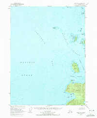
1951 Map of Craig C-6
USGS Topo · Published 1972About this map
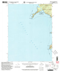
Noyes Island and the intricate archipelagos of the Tongass National Forest dominate this maritime survey of the Alexander Archipelago. Photogrammetric methods from 1948 capture the complex shoreline where Iphigenia Bay meets the Pacific Ocean. The map documents a rugged coastal landscape defined by navigational hazards and remote island groups, including the scattered Maurelle Islands and the more substantial St Joseph Island. On the northwestern shore of Noyes Island, prominent landmarks like Cape Ulitka protect the waters of Ulitka Bay, while further south the coast opens into the wide reach of Roller Bay. This mapping provides a snapshot of the Alaskan coastline before modern development, focusing on the essential topography of landmasses like Wood Islands and isolated features such as Timbered Island and Emerald Island.
Find a feature on this map
21 named features on this map. Tap any name to fly to it.
Don’t see what you’re looking for? This feature index may not catch every label — zoom into the map to look around manually.
Map Details
Editions of this 1951 Craig C-6 Map
4 editions found
Other maps of this area

1948 · Craig B-5
USGS Topo · 1:63,360

1948 · Craig B-6
USGS Topo · 1:63,360

1951 · Craig C-6
USGS Topo · 1:63,360

1951 · Craig D-6
USGS Topo · 1:63,360

1951 · Craig C-5
USGS Topo · 1:63,360

1951 · Craig D-5
USGS Topo · 1:63,360

1957 · Craig
USGS Topo · 1:250,000
1996 · Craig D-5
USGS Topo · 1:63,360
2000 · Craig B-6
USGS Topo · 1:63,360

2000 · Craig B-5
USGS Topo · 1:63,360