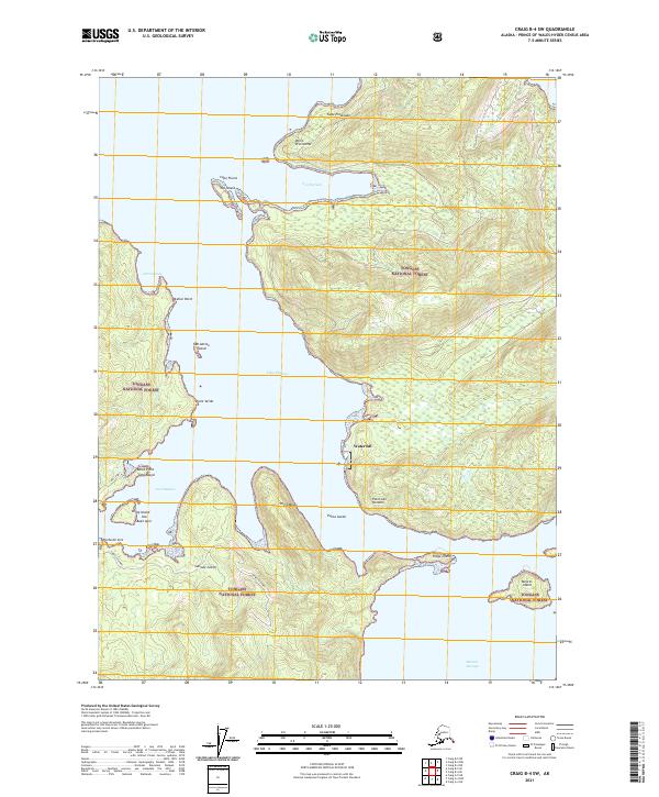
2021 Map of Craig B-4 SW
USGS Topo · Published 2021About this map
Waterfall stands as the primary settlement on this maritime landscape, positioned where the dense forests of the Tongass National Forest meet the coastal waters of the Ulloa Channel. The map illustrates a complex network of inlets and islands within the Prince of Wales-Hyder Census Area, characterized by numerous navigational landmarks such as Point San Antonio, Point Bocas, and Punta Gorda. The southern portion of the sheet shows the Suemez Highway providing land access near Suez Island, while the surrounding waters of West Port Refugio and Port Refugio define the local geography. This 2021 survey details the intricate shoreline of the Alexander Archipelago, where small landmasses like Ridge Island and Meares Island guard the entrance to Meares Passage.
Find a feature on this map
32 named features on this map. Tap any name to fly to it.
Don’t see what you’re looking for? This feature index may not catch every label — zoom into the map to look around manually.
Map Details
Editions of this 2021 Craig B-4 SW Map
This is the sole edition of this map. No revisions or reprints were ever made.
Other maps of this area

1948 · Craig A-4
USGS Topo · 1:63,360

1948 · Craig B-5
USGS Topo · 1:63,360

1948 · Craig A-5
USGS Topo · 1:63,360

1949 · Craig B-4
USGS Topo · 1:63,360

1951 · Craig B-4
USGS Topo · 1:63,360

1951 · Craig A-4
USGS Topo · 1:63,360

1957 · Craig
USGS Topo · 1:250,000
1994 · Craig A-4
USGS Topo · 1:63,360

2000 · Craig B-5
USGS Topo · 1:63,360
2017 · Craig B-4 NE
USGS Topo · 1:25,000