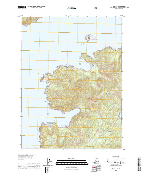
2021 Map of Craig B-5 SE
USGS Topo · Published 2021About this map
Suemez Island and its intricate coastline define this portion of the Tongass National Forest in the Alexander Archipelago. The landscape is characterized by a series of prominent headlands such as Point Arboleda and Point San Jose, which reach into the waters of Bucareli Bay. The map provides a detailed view of the island's interior road network, including the Suemez Highway and the Delores Byway, which navigate the island's high elevations.
Find a feature on this map
34 named features on this map. Tap any name to fly to it.
Don’t see what you’re looking for? This feature index may not catch every label — zoom into the map to look around manually.
Map Details
Editions of this 2021 Craig B-5 SE Map
This is the sole edition of this map. No revisions or reprints were ever made.
Other maps of this area

1948 · Craig A-4
USGS Topo · 1:63,360

1948 · Craig B-5
USGS Topo · 1:63,360

1948 · Craig A-5
USGS Topo · 1:63,360

1949 · Craig B-4
USGS Topo · 1:63,360

1951 · Craig B-4
USGS Topo · 1:63,360

1951 · Craig A-4
USGS Topo · 1:63,360

1957 · Craig
USGS Topo · 1:250,000
1994 · Craig A-4
USGS Topo · 1:63,360

2000 · Craig B-5
USGS Topo · 1:63,360
2017 · Craig A-5 NE
USGS Topo · 1:25,000