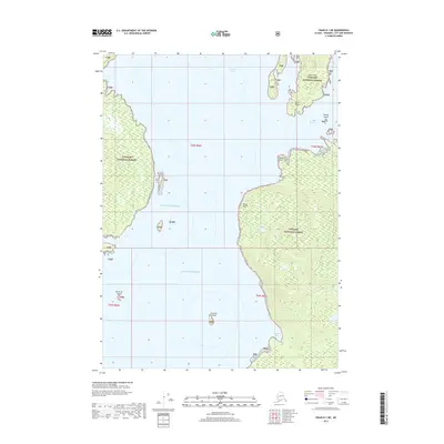
2017 Map of Craig D-1 NE
USGS Topo · Published 2017About this map
Tongass National Forest dominates this coastal Alaska landscape, where the waters of the Gulf of Alaska and the Pacific Ocean meet the intricate shoreline of the Alexander Archipelago. The survey focuses on a remote marine environment defined by deep channels and isolated landmasses. Large islands like Deer Island are characterized by steep coastal elevations and dense timber, while smaller outcrops such as Westerly Island, Easterly Island, and Change Island dot the surrounding passages. Significant navigational landmarks including Point Peters, Watkins Point, and Eaton Point serve as the primary geographical anchors for this maritime region. The transition from the open ocean into protected waterways like Ernest Sound and Seward Passage highlights the complex hydrography that has shaped the local fishing and timber economies for generations. Notable coastal indentations, such as Emerald Bay, provide a closer look at the interaction between the rainforest terrain and the sea.
Find a feature on this map
18 named features on this map. Tap any name to fly to it.
Don’t see what you’re looking for? This feature index may not catch every label — zoom into the map to look around manually.
Map Details
Editions of this 2017 Craig D-1 NE Map
This is the sole edition of this map. No revisions or reprints were ever made.
Other maps of this area

1948 · Petersburg A-1
USGS Topo · 1:63,360

1949 · Craig D-1
USGS Topo · 1:63,360

1951 · Bradfield Canal
USGS Topo · 1:250,000

1951 · Craig D-1
USGS Topo · 1:63,360

1951 · Petersburg A-1
USGS Topo · 1:63,360

1952 · Petersburg
USGS Topo · 1:250,000

1952 · Ketchikan
USGS Topo · 1:250,000

1952 · Ketchikan D-6
USGS Topo · 1:63,360

1953 · Ketchikan D-6
USGS Topo · 1:63,360

1954 · Bradfield Canal
USGS Topo · 1:250,000