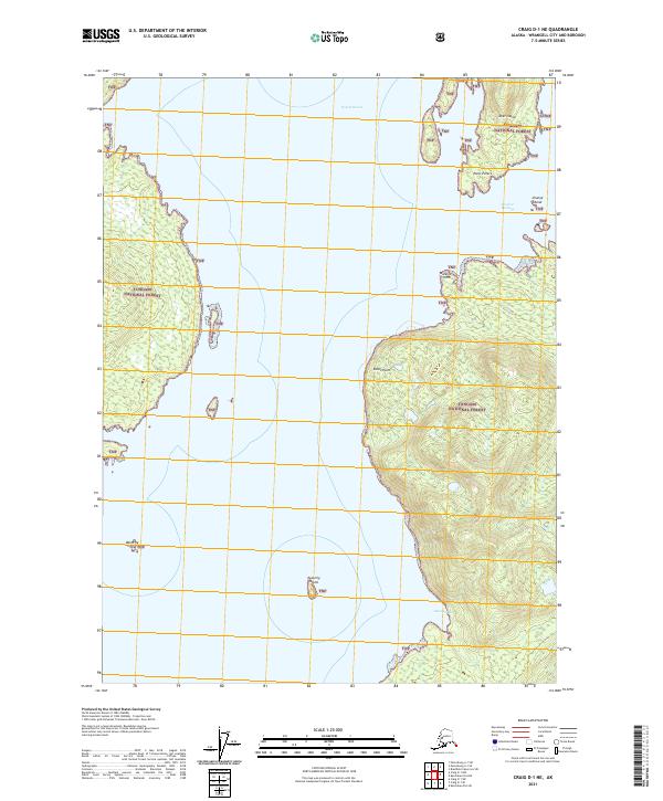
2021 Map of Craig D-1 NE
USGS Topo · Published 2021About this map
Tongass National Forest encompasses the vast majority of this maritime landscape in Southeast Alaska, where the dense timber of the Alexander Archipelago meets the deep waters of the Pacific. This 2021 survey documents the intricate shoreline of Deer Island and the surrounding waterways, including the broad reaches of Ernest Sound and the sheltered Seward Passage. The map provides a contemporary look at isolated coastal landmarks such as Point Peters, Watkins Point, and Eaton Point, which serve as critical navigation markers in these labyrinthine channels. Smaller landforms like Change Island, Easterly Island, and Westerly Island are also identified, highlighting the remote and primitive character of this region. The absence of roads or permanent settlements underscores the area's role as a protected wilderness, where the primary access remains by sea via inlets like Emerald Bay.
Find a feature on this map
16 named features on this map. Tap any name to fly to it.
Don’t see what you’re looking for? This feature index may not catch every label — zoom into the map to look around manually.
Map Details
Editions of this 2021 Craig D-1 NE Map
This is the sole edition of this map. No revisions or reprints were ever made.
Other maps of this area

1948 · Petersburg A-1
USGS Topo · 1:63,360

1949 · Craig D-1
USGS Topo · 1:63,360

1951 · Bradfield Canal
USGS Topo · 1:250,000

1951 · Craig D-1
USGS Topo · 1:63,360

1951 · Petersburg A-1
USGS Topo · 1:63,360

1952 · Petersburg
USGS Topo · 1:250,000

1952 · Ketchikan
USGS Topo · 1:250,000

1952 · Ketchikan D-6
USGS Topo · 1:63,360

1953 · Ketchikan D-6
USGS Topo · 1:63,360

1954 · Bradfield Canal
USGS Topo · 1:250,000