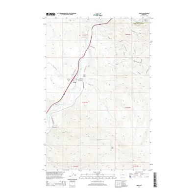
2014 Map of Craig
USGS Topo · Published 2014About this map
The Missouri River carves a deep valley through this portion of Lewis and Clark County, shaping the settlement and transportation patterns of the region. The town of Craig sits along the river's western bank, serving as a focal point for local travel with the Craig Bridge and the Wegner Creek Bridge facilitating passage across the water and its tributaries. To the north, the infrastructure of the rail line is marked by Tunnel Number 3, which pierces the high ground near the river bend. The landscape is defined by significant elevation changes, from the heights of Eagle Rock and Brewer Hill to the drainage of Bray Gulch. Local history and genealogy are anchored at the Craig Cemetery, located just northwest of the town center. Numerous named drainages like Stickney Creek, Dog Creek, and Burke Creek feed into the main river system, creating the complex topography that characterizes this Montana landscape.
Find a feature on this map
43 named features on this map. Tap any name to fly to it.
Don’t see what you’re looking for? This feature index may not catch every label — zoom into the map to look around manually.
Map Details
Editions of this 2014 Craig Map
This is the sole edition of this map. No revisions or reprints were ever made.
Other maps of this area

1886 · Great Falls
USGS Topo · 1:250,000

1886 · Fort Logan
USGS Topo · 1:250,000

1889 · Helena
USGS Topo · 1:250,000

1893 · Helena
USGS Topo · 1:250,000

1899 · Helena
USGS Topo · 1:250,000

1903 · Helena
USGS Topo · 1:250,000

1943 · Hogan
USGS Topo · 1:125,000

1947 · Butte
USGS Topo · 1:250,000

1948 · White Sulphur Springs
USGS Topo · 1:250,000

1954 · Great Falls
USGS Topo · 1:250,000