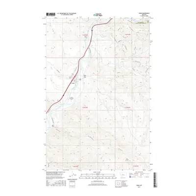
2017 Map of Craig
USGS Topo · Published 2017About this map
The Missouri River carves a deep valley through the center of this landscape, dictating the development of the small settlement of Craig along its western bank. In this 2017 study, the infrastructure of the canyon is clearly defined, with Craig Frontage Rd and Interstate 15 following the river's path, supported by engineering features like Tunnel Number 3 and the Craig Bridge. Local transit and access are facilitated by family-named routes such as Barnes Ln and Leonard St, while the community’s history is anchored at the Craig Cem overlooking the town.
Find a feature on this map
46 named features on this map. Tap any name to fly to it.
Don’t see what you’re looking for? This feature index may not catch every label — zoom into the map to look around manually.
Map Details
Editions of this 2017 Craig Map
This is the sole edition of this map. No revisions or reprints were ever made.
Other maps of this area

1886 · Great Falls
USGS Topo · 1:250,000

1886 · Fort Logan
USGS Topo · 1:250,000

1889 · Helena
USGS Topo · 1:250,000

1893 · Helena
USGS Topo · 1:250,000

1899 · Helena
USGS Topo · 1:250,000

1903 · Helena
USGS Topo · 1:250,000

1943 · Hogan
USGS Topo · 1:125,000

1947 · Butte
USGS Topo · 1:250,000

1948 · White Sulphur Springs
USGS Topo · 1:250,000

1954 · Great Falls
USGS Topo · 1:250,000