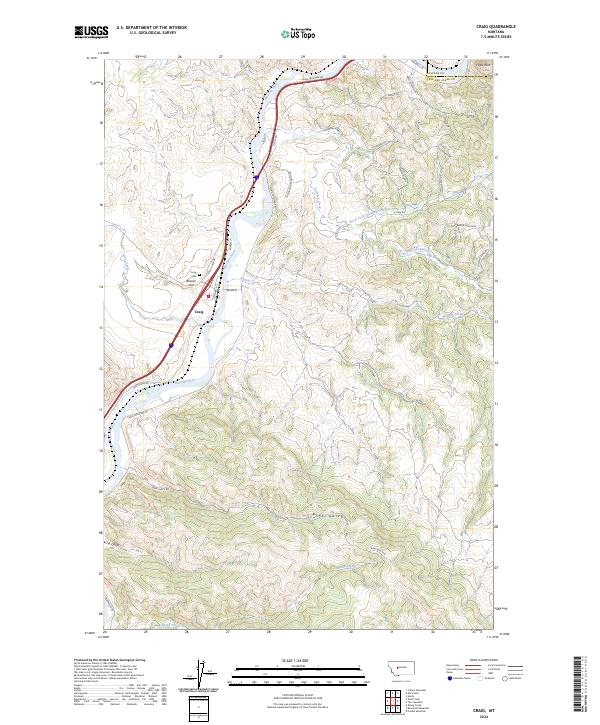
2024 Map of Craig
USGS Topo · Published 2024About this map
The Missouri River carves a deep valley through this landscape, defining the character of Craig and the surrounding river bluffs. This small community, situated at a bend in the river, serves as a focal point for the region's transport and local history. The map highlights the rugged topography of the Missouri River Bluff and prominent elevations such as Brewer Hill. To the west, Dog Creek feeds into the main waterway, while to the east, a complex drainage system includes Stickney Creek and its north and south forks. Genealogists and local historians can locate the Craig Cem overlooking the river valley, a quiet landmark near the town center. The network of winding roads like Craig River Rd and Bray Gulch Rd reveals how the terrain dictated early settlement patterns and access points to the river's edge.
Find a feature on this map
43 named features on this map. Tap any name to fly to it.
Don’t see what you’re looking for? This feature index may not catch every label — zoom into the map to look around manually.
Map Details
Editions of this 2024 Craig Map
This is the sole edition of this map. No revisions or reprints were ever made.
Other maps of this area

1886 · Great Falls
USGS Topo · 1:250,000

1886 · Fort Logan
USGS Topo · 1:250,000

1889 · Helena
USGS Topo · 1:250,000

1893 · Helena
USGS Topo · 1:250,000

1899 · Helena
USGS Topo · 1:250,000

1903 · Helena
USGS Topo · 1:250,000

1943 · Hogan
USGS Topo · 1:125,000

1947 · Butte
USGS Topo · 1:250,000

1948 · White Sulphur Springs
USGS Topo · 1:250,000

1954 · Great Falls
USGS Topo · 1:250,000