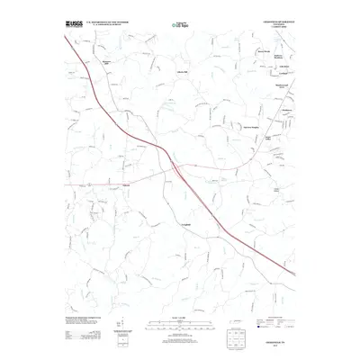
2013 Map of Craigfield
USGS Topo · Published 2013About this map
Spencers Mill and the headwaters of Big Turnbull Cr define the northern reaches of this rural Tennessee landscape. The area is marked by a complex network of creeks and branches, including Barren Fork and the Locust Fork, which drain the undulating terrain typical of this part of Williamson County. Small residential clusters and historic place names like Liberty Hill and Tidwell sit at crossroads, while newer developments such as Glenhaven and Hallview Meadows emerge near the eastern edge.
Find a feature on this map
161 named features on this map. Tap any name to fly to it.
Don’t see what you’re looking for? This feature index may not catch every label — zoom into the map to look around manually.
Map Details
Editions of this 2013 Craigfield Map
This is the sole edition of this map. No revisions or reprints were ever made.
Other maps of this area

1901 · Colombia
USGS Topo · 1:125,000

1930 · White Bluff
USGS Topo · 1:62,500

1933 · White Bluff
USGS Topo · 1:62,500

1936 · Primm
USGS Topo · 1:24,000

1936 · Littlelot
USGS Topo · 1:24,000

1936 · Theta
USGS Topo · 1:24,000

1936 · Burns
USGS Topo · 1:24,000

1936 · Craigfield
USGS Topo · 1:24,000

1936 · Lyles
USGS Topo · 1:24,000
1951 · Theta
USGS Topo · 1:24,000