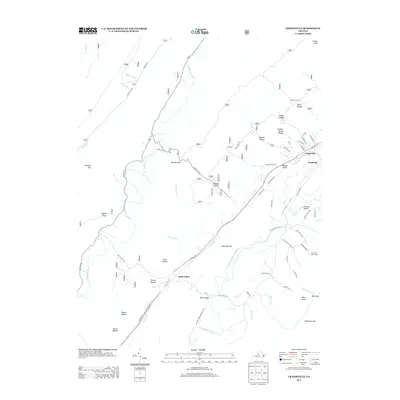
2013 Map of Craigsville
USGS Topo · Published 2013About this map
Craigsville and the adjacent industrial area of Fordwick anchor this section of Augusta County, situated where the Calfpasture River and Little Calfpasture River drain the eastern slopes of the Alleghany Mountains. The map reveals a landscape defined by sharp topographical contrasts, where narrow hollows like Sulphur Spring Hollow and Taylor Hollow lead into broader gaps and valleys. The presence of Casta Line Trout Farms and the Wilson Bridge near Bells Valley highlights the enduring importance of the river systems to local commerce and infrastructure. Transport routes follow the natural contours of the terrain, with Virginia Ave and the railroad corridor connecting these dispersed mountain settlements. This detailed study of the early 21st-century landscape preserves the locations of numerous family-named landmarks, from Kirtz Hollow to Wallace Draft, illustrating the persistent cultural geography of this Virginia highlands region.
Find a feature on this map
70 named features on this map. Tap any name to fly to it.
Don’t see what you’re looking for? This feature index may not catch every label — zoom into the map to look around manually.
Map Details
Editions of this 2013 Craigsville Map
This is the sole edition of this map. No revisions or reprints were ever made.
Other maps of this area

1894 · Staunton
USGS Topo · 1:125,000

1894 · Natural Bridge
USGS Topo · 1:125,000

1894 · Lexington
USGS Topo · 1:125,000

1901 · Monterey
USGS Topo · 1:125,000

1932 · Lexington
USGS Topo · 1:48,000

1937 · Lexington
USGS Topo · 1:62,500

1943 · Craigsville
USGS Topo · 1:62,500

1945 · Craigsville
USGS Topo · 1:62,500

1946 · Millboro
USGS Topo · 1:62,500

1946 · Williamsville
USGS Topo · 1:62,500