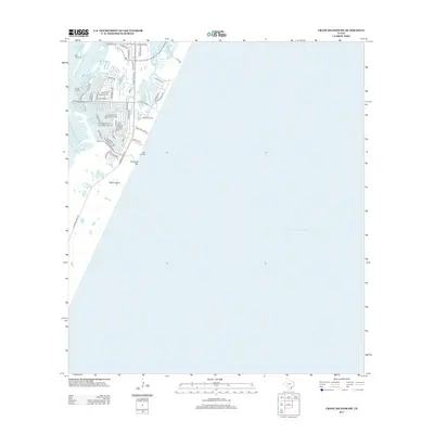
2013 Map of Crane Islands SW
USGS Topo · Published 2013About this map
Padre Island is depicted here during a period of significant residential and coastal development, where the residential canals of North Padre Island meet the waters of the Laguna Madre. The map illustrates a dense grid of modern street names like Whitecap Blvd and S Padre Island Dr, marking the transition from natural coastal dunes to a structured maritime community. Navigational aids such as Range A Light and the nearby Light station emphasize the area's importance for local boaters and commercial traffic moving through the Packery Channel. Along the eastern shore, the expanse of the Gulf of Mexico is accessible via the landmark Bob Hall Pier, while the natural elevation of Fourmile Hill provides one of the few distinct topographic features on this barrier island landscape.
Find a feature on this map
54 named features on this map. Tap any name to fly to it.
Don’t see what you’re looking for? This feature index may not catch every label — zoom into the map to look around manually.
Map Details
Editions of this 2013 Crane Islands SW Map
This is the sole edition of this map. No revisions or reprints were ever made.
Other maps of this area

1925 · Oso Creek
USGS Topo · 1:62,500

1950 · Corpus Christi
USGS Topo · 1:250,000

1951 · South Bird Island
USGS Topo · 1:24,000

1951 · Crane Islands NW
USGS Topo · 1:24,000

1951 · Oso Creek NE
USGS Topo · 1:24,000

1951 · Crane Islands SW
USGS Topo · 1:24,000

1951 · Oso Creek
USGS Topo · 1:62,500

1951 · Crane Islands
USGS Topo · 1:62,500

1951 · South Bird Island
USGS Topo · 1:62,500

1956 · Corpus Christi
USGS Topo · 1:250,000