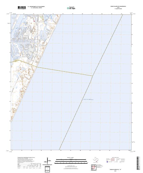
2025 Map of Crane Islands SW
USGS Topo · Published 2025About this map
Padre Island serves as the focal point for this coastal survey, where the developed residential canal systems of North Padre Island meet the open waters of the Gulf of America. The landscape is defined by the engineered intersection of the Intracoastal Waterway and Packery Channel, facilitating maritime traffic and recreational access. Residential growth is mapped through an intricate network of streets with nautical themes, such as Fortuna Bay Dr, Hawksnest Bay Dr, and Eaglesnest Bay Dr. This contemporary data shows the expansion of man-made finger canals and the prominence of Park Rd 22 as the primary transit artery across the island. The boundary between Nueces Co and Kleberg Co cuts through the southern portion of the developed area near Fourmile Hill, indicating the jurisdictional divide in this high-growth barrier island community.
Find a feature on this map
53 named features on this map. Tap any name to fly to it.
Don’t see what you’re looking for? This feature index may not catch every label — zoom into the map to look around manually.
Map Details
Editions of this 2025 Crane Islands SW Map
This is the sole edition of this map. No revisions or reprints were ever made.
Other maps of this area

1925 · Oso Creek
USGS Topo · 1:62,500

1950 · Corpus Christi
USGS Topo · 1:250,000

1951 · South Bird Island
USGS Topo · 1:24,000

1951 · Crane Islands NW
USGS Topo · 1:24,000

1951 · Oso Creek NE
USGS Topo · 1:24,000

1951 · Crane Islands SW
USGS Topo · 1:24,000

1951 · Oso Creek
USGS Topo · 1:62,500

1951 · Crane Islands
USGS Topo · 1:62,500

1951 · South Bird Island
USGS Topo · 1:62,500

1956 · Corpus Christi
USGS Topo · 1:250,000