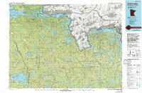
1978 Map of Crane Lake
USGS Topo · Published 1994About this map
Kabetogama Lake and Namakan Lake anchor this 1978 survey of the Minnesota-Ontario borderlands, a landscape defined by an intricate network of waterways and islands. The boundary between the United States and Canada threads through the King Williams Narrows and Vermilion Narrows, highlighting the region's historical reliance on water routes. On the American side, the Superior National Forest and Kabetogama State Forest cover vast stretches of timber, punctuated by fire lookouts like the Ash River Lookout Tower and Elephant Lake Lookout Tower.
Find a feature on this map
85 named features on this map. Tap any name to fly to it.
Don’t see what you’re looking for? This feature index may not catch every label — zoom into the map to look around manually.
Map Details
Editions of this 1978 Crane Lake Map
This is the sole edition of this map. No revisions or reprints were ever made.
Other maps of this area

1933 · Ely
USGS Topo · 1:62,500

1939 · Ely
USGS Topo · 1:62,500

1954 · Two Harbors
USGS Topo · 1:250,000

1954 · Hibbing
USGS Topo · 1:250,000

1954 · International Falls
USGS Topo · 1:250,000

1956 · Sioux Pine Island
USGS Topo · 1:24,000

1956 · Vermilion Dam
USGS Topo · 1:24,000

1956 · Chad Lake
USGS Topo · 1:24,000

1956 · Crab Lake
USGS Topo · 1:24,000

1957 · Two Harbors
USGS Topo · 1:250,000