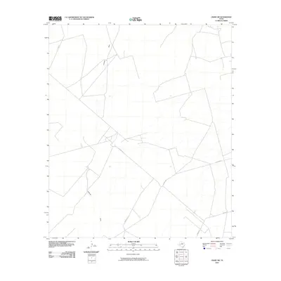
2010 Map of Crane SW
USGS Topo · Published 2010About this map
Landreth Draw and Horsehead Draw define the drainage of this West Texas landscape, cutting through a region where petroleum infrastructure and ranching access dominate the modern terrain. This 2010 survey reflects the specialized road network supporting the local energy economy, marked by utilitarian routes such as S Exxon Rd, S Cowden Rd, and Dawson Rd. The intricate web of local roads and 4WD tracks suggests an active industrial presence within Crane County, while the natural ephemeral waterways remain the primary topographical markers. Researchers and historians can use these specific alignments to trace property access and industrial development in a region shaped by resource extraction and the vast stretches of the Permian Basin.
Find a feature on this map
5 named features on this map. Tap any name to fly to it.
Don’t see what you’re looking for? This feature index may not catch every label — zoom into the map to look around manually.
Map Details
Editions of this 2010 Crane SW Map
This is the sole edition of this map. No revisions or reprints were ever made.
Other maps of this area

1928 · Crane
USGS Topo · 1:125,000

1954 · Pecos
USGS Topo · 1:250,000

1957 · Pecos
USGS Topo · 1:250,000
1972 · Buena Vista NE
USGS Topo · 1:24,000

1972 · Girvin NE
USGS Topo · 1:24,000
1972 · Girvin NW
USGS Topo · 1:24,000

1974 · Tubbs Corner
USGS Topo · 1:24,000

1974 · Crane SW
USGS Topo · 1:24,000
1974 · Crane
USGS Topo · 1:24,000

1974 · Juan Cordona Lake
USGS Topo · 1:24,000