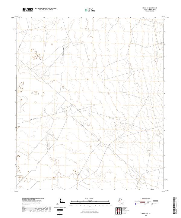
2022 Map of Crane SW
USGS Topo · Published 2022About this map
Landreth Draw carves a winding path across this arid landscape in Crane County, defining the drainage patterns of a region deeply connected to the Permian Basin's industrial infrastructure. The map reveals a network of roads that reflect the land's utility, serving as vital connectors between ranching interests and petroleum operations. These thoroughfares, including S Exxon Rd and Juan Cardona Lake Rd, navigate the subtle contours of the terrain where natural watercourses like the draw are the primary geographical markers.
Find a feature on this map
7 named features on this map. Tap any name to fly to it.
Don’t see what you’re looking for? This feature index may not catch every label — zoom into the map to look around manually.
Map Details
Editions of this 2022 Crane SW Map
This is the sole edition of this map. No revisions or reprints were ever made.
Other maps of this area

1928 · Crane
USGS Topo · 1:125,000

1954 · Pecos
USGS Topo · 1:250,000

1957 · Pecos
USGS Topo · 1:250,000
1972 · Buena Vista NE
USGS Topo · 1:24,000

1972 · Girvin NE
USGS Topo · 1:24,000
1972 · Girvin NW
USGS Topo · 1:24,000

1974 · Tubbs Corner
USGS Topo · 1:24,000

1974 · Crane SW
USGS Topo · 1:24,000
1974 · Crane
USGS Topo · 1:24,000

1974 · Juan Cordona Lake
USGS Topo · 1:24,000