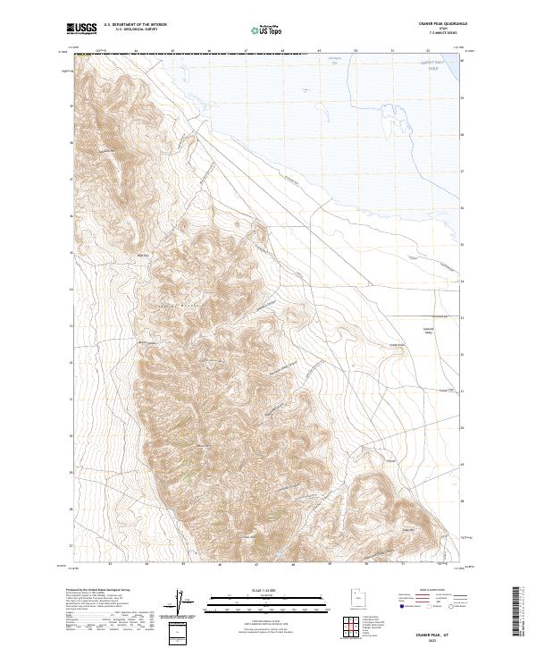
2023 Map of Craner Peak
USGS Topo · Published 2023About this map
The Lakeside Mountains rise sharply above the western shores of the Great Salt Lake, defining the high-desert profile of this portion of Tooele County. This landform-dominated landscape is centered on the 6,100-foot Craner Peak, which overlooks a series of drainages including Vindicator Canyon and Craner Canyon. To the northeast, the shoreline recedes into Carrington Bay, revealing the broad, level expanse of Lakeside Valley and Craner Flat. While much of the terrain is characterized by steep summits like Jedediah Mtn and Black Mtn, a network of primitive routes such as Lakeshore Way and Well Pass Rd provides access through the mountain passes. The presence of Craner Spring near the southern peaks highlights the rare water sources found within this arid, high-elevation environment.
Find a feature on this map
28 named features on this map. Tap any name to fly to it.
Don’t see what you’re looking for? This feature index may not catch every label — zoom into the map to look around manually.
Map Details
Editions of this 2023 Craner Peak Map
This is the sole edition of this map. No revisions or reprints were ever made.
Other maps of this area

1885 · Tooele Valley
USGS Topo · 1:250,000

1953 · Tooele
USGS Topo · 1:250,000

1954 · Brigham City
USGS Topo · 1:250,000

1955 · Tooele
USGS Topo · 1:250,000

1958 · Brigham City
USGS Topo · 1:250,000

1962 · Brigham City
USGS Topo · 1:250,000

1968 · Carrington Island SW
USGS Topo · 1:24,000

1968 · Poverty Point
USGS Topo · 1:24,000

1968 · Deardens Knoll
USGS Topo · 1:24,000

1968 · Badger Island NW
USGS Topo · 1:24,000