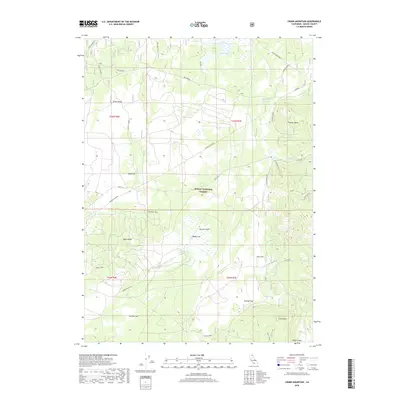
2018 Map of Crank Mountain
USGS Topo · Published 2018About this map
Modoc National Forest dominates this northern California landscape, characterized by a complex network of timber and access roads including Loveness Logging and the Webb Circle West. The terrain is punctuated by volcanic and erosional features such as Damon's Butte, Fleener Butte, and the Little Lavas, while several large, level areas like Webb Flat and Keeney Flat suggest the region's suitability for seasonal livestock grazing. Water management is central to the area's utility, evidenced by Courtright Reservoir and Webb Flat Reservoir, which capture runoff in an otherwise arid environment. Named springs including Mud Spring, Hess Spring, and Happy Camp Spring further emphasize the critical nature of water sources in this high-altitude territory. The naming of landmarks like Crank Mtn and Hess Flat reflects the history of local land use and the families who established themselves within this forest environment.
Find a feature on this map
38 named features on this map. Tap any name to fly to it.
Don’t see what you’re looking for? This feature index may not catch every label — zoom into the map to look around manually.
Map Details
Editions of this 2018 Crank Mountain Map
This is the sole edition of this map. No revisions or reprints were ever made.
Other maps of this area

1886 · Modoc Lava Bed
USGS Topo · 1:250,000

1892 · Modoc Lava-Bed
USGS Topo · 1:250,000

1952 · Timber Mountain
USGS Topo · 1:62,500

1952 · Hackamore
USGS Topo · 1:62,500

1954 · Alturas
USGS Topo · 1:250,000

1958 · Alturas
USGS Topo · 1:250,000

1962 · Alturas
USGS Topo · 1:250,000

1962 · Crank Mountain
USGS Topo · 1:62,500

1962 · White Horse
USGS Topo · 1:62,500

1965 · Alturas
USGS Topo · 1:250,000