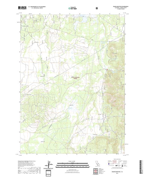
2021 Map of Crank Mountain
USGS Topo · Published 2021About this map
The high lava plateaus of the Modoc National Forest define this 2021 landscape, where volcanic topography and timber management intersect. Distinctive features like Little Lavas and Fleener Butte characterize the terrain, while the extensive reach of Loveness Logging roads indicates the area's ongoing economic utility. Water management is central to this environment, evidenced by the Courtright Reservoir and Webb Flat Reservoir, alongside vital natural sources such as Mud Lake and Mud Spring. Named flats, including Sand Flat and Service Flat, provide localized orientation within the forest's sectioned townships. For researchers, the map traces modern forestry access via routes like Webb Circle West and Webb Circle East that loop around Webb Butte.
Find a feature on this map
28 named features on this map. Tap any name to fly to it.
Don’t see what you’re looking for? This feature index may not catch every label — zoom into the map to look around manually.
Map Details
Editions of this 2021 Crank Mountain Map
This is the sole edition of this map. No revisions or reprints were ever made.
Other maps of this area

1886 · Modoc Lava Bed
USGS Topo · 1:250,000

1892 · Modoc Lava-Bed
USGS Topo · 1:250,000

1952 · Timber Mountain
USGS Topo · 1:62,500

1952 · Hackamore
USGS Topo · 1:62,500

1954 · Alturas
USGS Topo · 1:250,000

1958 · Alturas
USGS Topo · 1:250,000

1962 · Alturas
USGS Topo · 1:250,000

1962 · Crank Mountain
USGS Topo · 1:62,500

1962 · White Horse
USGS Topo · 1:62,500

1965 · Alturas
USGS Topo · 1:250,000