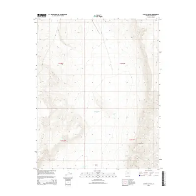
2014 Map of Crater Canyon
USGS Topo · Published 2014About this map
Aubrey Valley dominates this high-desert plateau region within Coconino County, characterized by its wide basins and dramatic elevation changes. The rugged eastern edge of the valley is defined by the Aubrey Cliffs, a massive escarpment that transitions the landscape toward the Crater Canyon and its associated drainage systems. This 2014 survey documents a territory defined by specialized water management, where artificial catchments like Jake McCain Tank and Trible Tank are essential landmarks for land use. Transportation across this remote area relies on Bureau of Indian Affairs routes, specifically Bia-18 and Bia-20, which provide the primary access through the townships of t27n r8w and t27n r7w. The map preserves the precise locations of these water sources and the topography of the cliffs before modern development could further alter the landscape.
Find a feature on this map
13 named features on this map. Tap any name to fly to it.
Don’t see what you’re looking for? This feature index may not catch every label — zoom into the map to look around manually.
Map Details
Editions of this 2014 Crater Canyon Map
This is the sole edition of this map. No revisions or reprints were ever made.
Other maps of this area

1886 · Diamond Creek
USGS Topo · 1:250,000

1886 · Chino
USGS Topo · 1:250,000

1891 · Chino
USGS Topo · 1:250,000

1892 · Diamond Creek
USGS Topo · 1:250,000

1948 · Williams
USGS Topo · 1:250,000

1954 · Williams
USGS Topo · 1:250,000

1956 · Williams
USGS Topo · 1:250,000

1960 · Williams
USGS Topo · 1:250,000

1961 · Williams
USGS Topo · 1:250,000
1967 · Frazier Wells
USGS Topo · 1:24,000