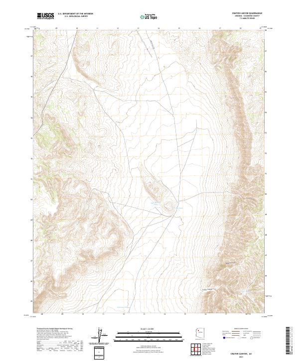
2021 Map of Crater Canyon
USGS Topo · Published 2021About this map
Aubrey Cliffs dominate the eastern portion of this high-altitude landscape in Coconino County, Arizona. This area of the Coconino plateau is characterized by its reliance on water management for ranching and wildlife, evidenced by a series of named catchment systems including Jake McCain Tank, Trible Tank, and Antelope Tank. The terrain drops significantly into Crater Canyon in the southeast, a primary geographical feature of the township. Access to this remote portion of the high desert is defined by Frazier Wells Rd, which cuts across the northern section of the map, providing a glimpse into the modern infrastructure used to navigate this arid environment. The map details four distinct township and range sections, including t27n r8w and t26n r7w, illustrating the geometric land division of the American West.
Find a feature on this map
11 named features on this map. Tap any name to fly to it.
Don’t see what you’re looking for? This feature index may not catch every label — zoom into the map to look around manually.
Map Details
Editions of this 2021 Crater Canyon Map
This is the sole edition of this map. No revisions or reprints were ever made.
Other maps of this area

1886 · Diamond Creek
USGS Topo · 1:250,000

1886 · Chino
USGS Topo · 1:250,000

1891 · Chino
USGS Topo · 1:250,000

1892 · Diamond Creek
USGS Topo · 1:250,000

1948 · Williams
USGS Topo · 1:250,000

1954 · Williams
USGS Topo · 1:250,000

1956 · Williams
USGS Topo · 1:250,000

1960 · Williams
USGS Topo · 1:250,000

1961 · Williams
USGS Topo · 1:250,000
1967 · Frazier Wells
USGS Topo · 1:24,000