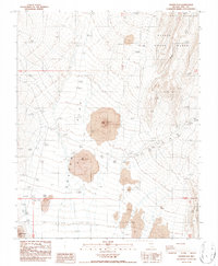
1986 Map of Crater Flat
USGS Topo · Published 1986About this map
Black Cone and Red Cone dominate the arid basin of Crater Flat in this mid-1980s geological study of Nye County. The landscape is defined by extensive Lava flows and volcanic cinder cones, situated within the restricted boundaries of the Nellis Air Force Range. To the east, the rising terrain of Yucca Mountain overlooks Windy Wash, a prominent drainage through the high desert.
Find a feature on this map
17 named features on this map. Tap any name to fly to it.
Don’t see what you’re looking for? This feature index may not catch every label — zoom into the map to look around manually.
Map Details
Editions of this 1986 Crater Flat Map
This is the sole edition of this map. No revisions or reprints were ever made.
Other maps of this area

1908 · Furnace Creek
USGS Topo · 1:250,000

1910 · Furnace Creek
USGS Topo · 1:250,000

1942 · Skull Mountain
USGS Topo · 1:125,000

1942 · Bullfrog
USGS Topo · 1:125,000

1948 · Death Valley
USGS Topo · 1:250,000

1952 · Topopah Spring
USGS Topo · 1:62,500

1952 · Big Dune
USGS Topo · 1:62,500

1954 · Bare Mtn
USGS Topo · 1:62,500

1954 · Death Valley
USGS Topo · 1:250,000

1956 · Death Valley
USGS Topo · 1:250,000