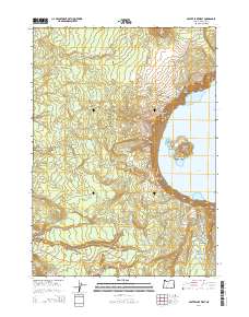
2014 Map of Crater Lake West
USGS Topo · Published 2014About this map
Wizard Island and its prominent Witches Cauldron sit at the center of this volcanic landscape, defining the western portion of Crater Lake National Park. The survey highlights the dramatic elevation changes along the Rim of the Crater, where landmarks like Llao Rock, The Watchman, and Hillman Peak tower above the water. A complex network of drainage systems, including N Fork Copeland Cr and Little Castle Cr, flows westward away from the caldera toward the Summit Cascade Divide. Human presence is concentrated around the established visitor infrastructure at Rim Village and the winding path of Rim Dr, which follows the precipitous edge. The Pacific Crest National Scenic Trail traverses the western slopes, providing a through-route that connects features such as Red Cone and Llaos Hallway within this preserved geologic environment.
Find a feature on this map
50 named features on this map. Tap any name to fly to it.
Don’t see what you’re looking for? This feature index may not catch every label — zoom into the map to look around manually.
Map Details
Editions of this 2014 Crater Lake West Map
This is the sole edition of this map. No revisions or reprints were ever made.
Other maps of this area

1891 · Ashland
USGS Topo · 1:250,000

1893 · Ashland
USGS Topo · 1:250,000

1897 · Ashland
USGS Topo · 1:250,000

1917 · Diamond Lake
USGS Topo · 1:125,000

1955 · Medford
USGS Topo · 1:250,000

1956 · Diamond Lake
USGS Topo · 1:62,500

1956 · Garwood Butte
USGS Topo · 1:62,500

1956 · Prospect
USGS Topo · 1:62,500

1957 · Medford
USGS Topo · 1:250,000

1958 · Medford
USGS Topo · 1:250,000