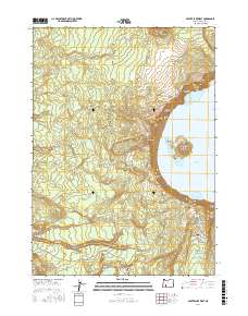
2017 Map of Crater Lake West
USGS Topo · Published 2017About this map
Crater Lake National Park is defined here by the sharp descent from the Rim of the Crater down to the deep waters of Crater Lake. The western half of the caldera is captured in meticulous detail, featuring the iconic Witches Cauldron Wizard Island and the narrow passage of Skell Channel. The landscape is a complex of volcanic landforms, from the towering heights of Hillman Peak and The Watchman to the dramatic formations of Llao Rock and the Devils Backbone. Moving west away from the rim, the terrain transitions into a network of drainage basins including the N Fork Castle Cr and Copeland Cr. This 2017 survey documents the modern layout of the Pacific Crest National Scenic Trail as it winds through the wilderness, providing a clear record of the access roads and infrastructure within Munson Valley and along Rim Dr.
Find a feature on this map
51 named features on this map. Tap any name to fly to it.
Don’t see what you’re looking for? This feature index may not catch every label — zoom into the map to look around manually.
Map Details
Editions of this 2017 Crater Lake West Map
This is the sole edition of this map. No revisions or reprints were ever made.
Other maps of this area

1891 · Ashland
USGS Topo · 1:250,000

1893 · Ashland
USGS Topo · 1:250,000

1897 · Ashland
USGS Topo · 1:250,000

1917 · Diamond Lake
USGS Topo · 1:125,000

1955 · Medford
USGS Topo · 1:250,000

1956 · Diamond Lake
USGS Topo · 1:62,500

1956 · Garwood Butte
USGS Topo · 1:62,500

1956 · Prospect
USGS Topo · 1:62,500

1957 · Medford
USGS Topo · 1:250,000

1958 · Medford
USGS Topo · 1:250,000