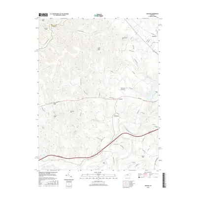
2016 Map of Cravens
USGS Topo · Published 2016About this map
Beech Fork meanders through the southern half of this landscape, anchoring a region defined by scattered knobs and rural river bottomlands. The settlement of Cravens sits centrally along Boston Rd, serving as a focal point near specialized aviation sites like the Greene County Parachute Center Airport and Samuels Field. Local history is preserved at the Sutherland Cem near the eastern margin, while the terrain is marked by prominent elevations such as Crutchers Knob, Allens Knob, and Indian Grave Ridge. The hydrography of the area is complex, with numerous drainages like Tewell Cr, Lick Cr, and Cedar Cr feeding into the larger river system. North of the river, the landscape transitions into the higher elevations of Germantown Hill and the ridge lines overlooking Harrison Cr, illustrating the deeply dissected topography of Nelson County.
Find a feature on this map
69 named features on this map. Tap any name to fly to it.
Don’t see what you’re looking for? This feature index may not catch every label — zoom into the map to look around manually.
Map Details
Editions of this 2016 Cravens Map
This is the sole edition of this map. No revisions or reprints were ever made.
Other maps of this area

1949 · Cravens
USGS Topo · 1:24,000

1949 · Shepherdsville
USGS Topo · 1:24,000

1949 · Samuels
USGS Topo · 1:24,000

1949 · Shepherdsville
USGS Topo · 1:62,500

1953 · Loretto
USGS Topo · 1:24,000

1953 · Nelsonville
USGS Topo · 1:24,000

1953 · Bardstown
USGS Topo · 1:24,000

1953 · New Haven
USGS Topo · 1:24,000

1953 · Fairfield
USGS Topo · 1:24,000

1957 · Winchester
USGS Topo · 1:250,000