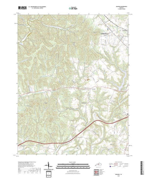
2022 Map of Cravens
USGS Topo · Published 2022About this map
The winding course of Beech Fork and its tributary Cedar Cr anchor the southern landscape of this Nelson County territory. To the north, the terrain transitions into more pronounced ridges and valleys, including Indian Grave Ridge and the darkly named Spooky Hollow. This modern survey illustrates the edge of Bardstown, where the street grid begins to break into the rural hills and hollows that have defined the region's geography for generations. Local history is traced through small clusters such as Cravens and Bellwood, while aviation history is marked by Samuels Field near the eastern boundary. The presence of family-named peaks like Allens Knob and Crutchers Knob reflects a legacy of local land ownership, while the Sutherland Cem near the fork serves as a point of interest for genealogical research.
Find a feature on this map
71 named features on this map. Tap any name to fly to it.
Don’t see what you’re looking for? This feature index may not catch every label — zoom into the map to look around manually.
Map Details
Editions of this 2022 Cravens Map
This is the sole edition of this map. No revisions or reprints were ever made.
Other maps of this area

1949 · Cravens
USGS Topo · 1:24,000

1949 · Shepherdsville
USGS Topo · 1:24,000

1949 · Samuels
USGS Topo · 1:24,000

1949 · Shepherdsville
USGS Topo · 1:62,500

1953 · Loretto
USGS Topo · 1:24,000

1953 · Nelsonville
USGS Topo · 1:24,000

1953 · Bardstown
USGS Topo · 1:24,000

1953 · New Haven
USGS Topo · 1:24,000

1953 · Fairfield
USGS Topo · 1:24,000

1957 · Winchester
USGS Topo · 1:250,000