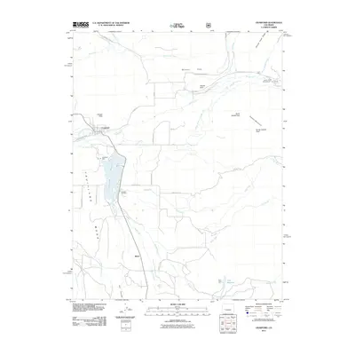
2011 Map of Crawford
USGS Topo · Published 2011About this map
Crawford serves as a central hub on this landscape, positioned north of the expansive Crawford Reservoir. The town's surrounding agricultural and ranching infrastructure is highly evident through an intricate network of irrigation systems, including the Grand View Ditch, Aspen Ditch, and Gould Canal, which draw from water sources like the Smith Fork. To the south lies the settlement of Maher, situated near Alkali Creek and Iron Creek.
Find a feature on this map
45 named features on this map. Tap any name to fly to it.
Don’t see what you’re looking for? This feature index may not catch every label — zoom into the map to look around manually.
Map Details
Editions of this 2011 Crawford Map
This is the sole edition of this map. No revisions or reprints were ever made.
Other maps of this area

1938 · Mt. Gunnison
USGS Topo · 1:48,000

1945 · Mount Gunnison
USGS Topo · 1:62,500

1956 · Montrose
USGS Topo · 1:250,000

1957 · Cathedral Peak
USGS Topo · 1:24,000

1957 · X Lazy F Ranch
USGS Topo · 1:24,000

1957 · Grizzly Ridge
USGS Topo · 1:24,000

1959 · Montrose
USGS Topo · 1:250,000

1960 · Montrose
USGS Topo · 1:250,000

1964 · Minnesota Pass
USGS Topo · 1:24,000

1965 · Mount Guero
USGS Topo · 1:24,000