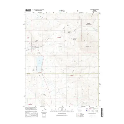
2016 Map of Crawford
USGS Topo · Published 2016About this map
Crawford serves as the primary settlement on this Delta County landscape, positioned north of the expansive Fruitland Mesa. The geography is defined by a sophisticated network of early water management features, including the Crawford Clipper Ditch, Grand View Ditch, and the Saddle Mountain Highline Ditch, which redirect flow from sources like Cottonwood Cr and the Clear Fork to support high-altitude agriculture. Near the town site, the Crawford Cem and the Collins Family Cem provide specific points of interest for genealogists tracing local families.
Find a feature on this map
56 named features on this map. Tap any name to fly to it.
Don’t see what you’re looking for? This feature index may not catch every label — zoom into the map to look around manually.
Map Details
Editions of this 2016 Crawford Map
This is the sole edition of this map. No revisions or reprints were ever made.
Other maps of this area

1938 · Mt. Gunnison
USGS Topo · 1:48,000

1945 · Mount Gunnison
USGS Topo · 1:62,500

1956 · Montrose
USGS Topo · 1:250,000

1957 · Cathedral Peak
USGS Topo · 1:24,000

1957 · X Lazy F Ranch
USGS Topo · 1:24,000

1957 · Grizzly Ridge
USGS Topo · 1:24,000

1959 · Montrose
USGS Topo · 1:250,000

1960 · Montrose
USGS Topo · 1:250,000

1964 · Minnesota Pass
USGS Topo · 1:24,000

1965 · Mount Guero
USGS Topo · 1:24,000