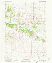
1981 Map of Crawfordsville
USGS Topo · Published 1981About this map
Crawfordsville sits as the primary settlement in this 1981 survey of southeastern Iowa, where the agricultural landscape meets the winding drainage of the Marion Fork and Crooked Creek. The map documents a rural society deeply rooted in its local institutions, evidenced by a high density of country graveyards such as Benson Cem, North Wayne Cem, and Asbury Cem. Near the community of Noble, the terrain transitions into the more varied topography of Fern Cliff County Park.
Find a feature on this map
23 named features on this map. Tap any name to fly to it.
Don’t see what you’re looking for? This feature index may not catch every label — zoom into the map to look around manually.
Map Details
Editions of this 1981 Crawfordsville Map
This is the sole edition of this map. No revisions or reprints were ever made.
Other maps of this area

1958 · Davenport
USGS Topo · 1:250,000

1961 · Davenport
USGS Topo · 1:250,000

1962 · Davenport
USGS Topo · 1:250,000

1969 · Washington
USGS Topo · 1:24,000

1970 · Cotter
USGS Topo · 1:24,000

1970 · Ainsworth
USGS Topo · 1:24,000

1980 · Trenton
USGS Topo · 1:24,000

1980 · Wayland
USGS Topo · 1:24,000
1981 · Winfield North
USGS Topo · 1:24,000
1981 · Swedesburg
USGS Topo · 1:24,000