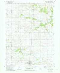
1981 Map of Winfield North
USGS Topo · Published 1981About this map
Winfield and the surrounding farmland of southern Louisa County are captured in this 1981 survey, reflecting the rural character of southeastern Iowa in the late twentieth century. The landscape is defined by the winding paths of Long Creek and the East Fork Crooked Creek, which provide drainage for the productive fields of Elm Grove and Scott townships. A significant historical marker is the Old Railroad Grade running through the southern section, tracing the path of a decommissioned rail line that once connected these agricultural communities to regional markets.
Find a feature on this map
28 named features on this map. Tap any name to fly to it.
Don’t see what you’re looking for? This feature index may not catch every label — zoom into the map to look around manually.
Map Details
Editions of this 1981 Winfield North Map
This is the sole edition of this map. No revisions or reprints were ever made.
Other maps of this area

1958 · Davenport
USGS Topo · 1:250,000

1961 · Davenport
USGS Topo · 1:250,000

1962 · Davenport
USGS Topo · 1:250,000

1970 · Cotter
USGS Topo · 1:24,000
1970 · Columbus Junction
USGS Topo · 1:24,000

1970 · Ainsworth
USGS Topo · 1:24,000
1981 · Cairo
USGS Topo · 1:24,000
1981 · Crawfordsville
USGS Topo · 1:24,000
1981 · Morning Sun
USGS Topo · 1:24,000
1981 · Swedesburg
USGS Topo · 1:24,000