
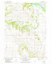
1970 Map of Cotter
USGS Topo · Published 1972About this map
The Iowa River winds through the northeastern corner of this 1970 landscape, defining the boundaries of Oakland and Union townships. This river corridor was a critical junction for transportation, where the Chicago Milwaukee St Paul and Pacific railroad crossed the water near Gladwin. Further south, the town of Cotter serves as a central point along the Chicago Rock Island and Pacific tracks, accompanied by the Cotter Ch.
Find a feature on this map
26 named features on this map. Tap any name to fly to it.
Don’t see what you’re looking for? This feature index may not catch every label — zoom into the map to look around manually.
Map Details
Editions of this 1970 Cotter Map
This is the sole edition of this map. No revisions or reprints were ever made.
Other maps of this area

1958 · Davenport
USGS Topo · 1:250,000

1961 · Davenport
USGS Topo · 1:250,000

1962 · Davenport
USGS Topo · 1:250,000
1969 · Riverside
USGS Topo · 1:24,000
1969 · Lone Tree
USGS Topo · 1:24,000
1970 · Columbus Junction
USGS Topo · 1:24,000
1970 · Nichols
USGS Topo · 1:24,000

1970 · Ainsworth
USGS Topo · 1:24,000
1981 · Cairo
USGS Topo · 1:24,000
1981 · Crawfordsville
USGS Topo · 1:24,000