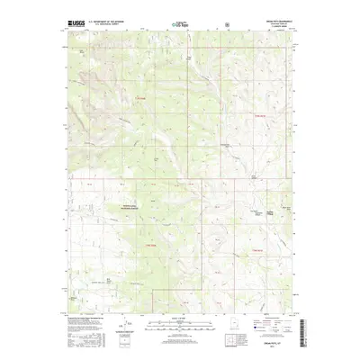
2017 Map of Cream Pots
USGS Topo · Published 2017About this map
Indian Village sits within the complex drainage systems of San Juan County, positioned near the junction of Dry Wash and Cottonwood Cr. This high-altitude landscape is defined by the transition from the timbered heights of the Manti-LaSal National Forest down into the erosional features of the Cream Pots and Hammond Canyon. The presence of several named trails, such as the Posey Canyon Trail and Whiskers Trail (472), suggests a network of access through terrain that has long served as vital range land and seasonal territory.
Find a feature on this map
38 named features on this map. Tap any name to fly to it.
Don’t see what you’re looking for? This feature index may not catch every label — zoom into the map to look around manually.
Map Details
Editions of this 2017 Cream Pots Map
This is the sole edition of this map. No revisions or reprints were ever made.
Other maps of this area

1886 · Abajo
USGS Topo · 1:250,000

1892 · Abajo
USGS Topo · 1:250,000

1893 · Abajo
USGS Topo · 1:250,000

1935 · Elk Ridge
USGS Topo · 1:96,000

1940 · Elk Ridge
USGS Topo · 1:125,000

1954 · Elk Ridge 4 NW
USGS Topo · 1:24,000

1954 · Elk Ridge 1 SW
USGS Topo · 1:24,000

1954 · Elk Ridge 2 SE
USGS Topo · 1:24,000

1954 · Elk Ridge 3 NE
USGS Topo · 1:24,000

1954 · Elk Ridge 1 SE
USGS Topo · 1:24,000