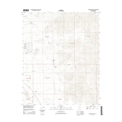
2014 Map of Creamery Canyon
USGS Topo · Published 2014About this map
Creamery Canyon and Cottonwood Canyon carve through this section of the Mojave Desert in Mohave County, revealing a landscape defined by seasonal water drainage and historical travel routes. The 2014 survey shows a fascinating intersection of modern rural development and western frontier heritage, with roads named for legendary figures including Wyatt Earp Rd, Calamity Jane Rd, and Bat Masterson Rd. These corridors navigate the varied terrain of Round Valley and the expansive Dutch Flat to the south.
Find a feature on this map
41 named features on this map. Tap any name to fly to it.
Don’t see what you’re looking for? This feature index may not catch every label — zoom into the map to look around manually.
Map Details
Editions of this 2014 Creamery Canyon Map
This is the sole edition of this map. No revisions or reprints were ever made.
Other maps of this area

1923 · Signal
USGS Topo · 1:250,000

1927 · Yucca
USGS Topo · 1:62,500

1927 · Buck Mountains
USGS Topo · 1:62,500

1929 · Buck Mountains
USGS Topo · 1:62,500

1929 · Yucca
USGS Topo · 1:62,500

1942 · Signal
USGS Topo · 1:250,000

1950 · Prescott
USGS Topo · 1:250,000

1954 · Needles
USGS Topo · 1:250,000

1954 · Prescott
USGS Topo · 1:250,000

1956 · Needles
USGS Topo · 1:250,000