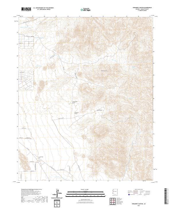
2021 Map of Creamery Canyon
USGS Topo · Published 2021About this map
Creamery Canyon and the surrounding high desert of Mohave County are defined by a complex network of seasonal watercourses and remote ranching infrastructure. This modern survey illustrates the rugged topography between the Mojave Desert and the rising elevations of the regional canyons. Named features like Blue Mary Spring and Cottonwood Spring highlight the critical role of water sources in this arid landscape, while Haystack Tank suggests a history of livestock management.
Find a feature on this map
36 named features on this map. Tap any name to fly to it.
Don’t see what you’re looking for? This feature index may not catch every label — zoom into the map to look around manually.
Map Details
Editions of this 2021 Creamery Canyon Map
This is the sole edition of this map. No revisions or reprints were ever made.
Other maps of this area

1923 · Signal
USGS Topo · 1:250,000

1927 · Yucca
USGS Topo · 1:62,500

1927 · Buck Mountains
USGS Topo · 1:62,500

1929 · Buck Mountains
USGS Topo · 1:62,500

1929 · Yucca
USGS Topo · 1:62,500

1942 · Signal
USGS Topo · 1:250,000

1950 · Prescott
USGS Topo · 1:250,000

1954 · Needles
USGS Topo · 1:250,000

1954 · Prescott
USGS Topo · 1:250,000

1956 · Needles
USGS Topo · 1:250,000