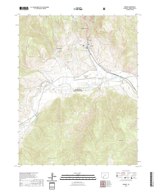
2022 Map of Creede
USGS Topo · Published 2022About this map
City of Creede sits as the central hub of this mountain landscape, positioned where the steep drainages of Willow Cr and E Willow Cr meet. The settlement pattern follows the narrow canyon floors, extending north to North Creede and west toward Sunnyside, while the Mineral County Courthouse stands as a civic anchor near the Creede Cem. The terrain is defined by extreme relief, from the heights of Snowshoe Mtn and Bulldog Mtn down to the wider valley of the Rio Grande. This corridor is managed as part of the Rio Grande National Forest, where a network of trails like the Miner's Creek Trl and McKenzie Trl traverse rugged gulches including Sawmill Gully and Gardner Gulch, illustrating the transition from mining-era settlements to a landscape shaped by conservation and mountain aviation at the Mineral County Memorial Airport.
Find a feature on this map
43 named features on this map. Tap any name to fly to it.
Don’t see what you’re looking for? This feature index may not catch every label — zoom into the map to look around manually.
Map Details
Editions of this 2022 Creede Map
This is the sole edition of this map. No revisions or reprints were ever made.
Other maps of this area

1905 · San Cristobal
USGS Topo · 1:125,000

1907 · San Cristobal
USGS Topo · 1:125,000

1914 · Creede
USGS Topo · 1:125,000

1916 · Creede
USGS Topo · 1:125,000

1945 · Durango
USGS Topo · 1:250,000

1953 · Durango
USGS Topo · 1:250,000

1954 · Durango
USGS Topo · 1:250,000

1957 · Spar City
USGS Topo · 1:62,500

1959 · Creede
USGS Topo · 1:62,500

1959 · Bristol Head
USGS Topo · 1:62,500