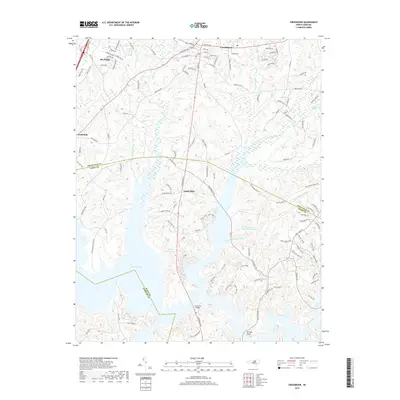
2019 Map of Creedmoor
USGS Topo · Published 2019About this map
The town of Creedmoor and the neighboring community of Butner anchor this survey of the Piedmont landscape where Granville, Wake, and Durham counties converge. This modern documentation illustrates a region defined by its expansive water resources, including Willowhaven Lake Number One and Brinkley Lake, which have reshaped the historical drainages of Ledge Creek and Beaverdam Creek. The settlement patterns of Sandy Plain and North Side are visible alongside a dense network of local roads such as E Lyon Station Rd and Joe Reed Rd, reflecting late 20th-century growth and residential development. Transportation remains centered on the Csx rail corridor and major thoroughfares like S Main St. Local landmarks like Lawrences Bridge and Newlight Bridge provide specific points of reference for genealogists tracking family land tracts across these county lines.
Find a feature on this map
124 named features on this map. Tap any name to fly to it.
Don’t see what you’re looking for? This feature index may not catch every label — zoom into the map to look around manually.
Map Details
Editions of this 2019 Creedmoor Map
This is the sole edition of this map. No revisions or reprints were ever made.
Other maps of this area

1943 · Durham South
USGS Topo · 1:62,500

1943 · Raleigh
USGS Topo · 1:62,500

1943 · Creedmoor
USGS Topo · 1:62,500

1944 · Creedmoor
USGS Topo · 1:62,500

1951 · Raleigh
USGS Topo · 1:62,500

1951 · Durham South
USGS Topo · 1:62,500

1951 · Durham North
USGS Topo · 1:62,500

1953 · Raleigh
USGS Topo · 1:250,000

1953 · Greensboro
USGS Topo · 1:250,000

1954 · Greensboro
USGS Topo · 1:250,000