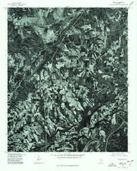
1975 Map of Creel
USGS Topo · Published 1977About this map
Mulberry Fork and Locust Fork dominate the landscape of Jefferson County in the mid-1970s. This orthophotoquad provides a detailed aerial perspective of the rural terrain, where the meandering river systems carve through a mosaic of forested ridges and agricultural clearings. Produced in cooperation with the Soil Conservation Service, the map highlights the intricate relationship between the region's topography and its land-use patterns during this era. The distinct lack of dense residential development reveals a period when the area remained primarily rural, defined by the winding paths of its major waterways and the surrounding timberland.
Find a feature on this map
2 named features on this map. Tap any name to fly to it.
Don’t see what you’re looking for? This feature index may not catch every label — zoom into the map to look around manually.
Map Details
Editions of this 1975 Creel Map
This is the sole edition of this map. No revisions or reprints were ever made.
Other maps of this area

1889 · Birmingham
USGS Topo · 1:125,000

1892 · Birmingham
USGS Topo · 1:125,000

1893 · Jasper
USGS Topo · 1:125,000

1895 · Birmingham
USGS Topo · 1:125,000

1904 · Birmingham Coal District
USGS Topo · 1:62,500

1906 · Birmingham Special
USGS Topo · 1:62,500

1907 · Birmingham
USGS Topo · 1:125,000

1935 · Port Birmingham
USGS Topo · 1:48,000

1938 · Port Birmingham
USGS Topo · 1:62,500

1949 · Sipsey
USGS Topo · 1:24,000