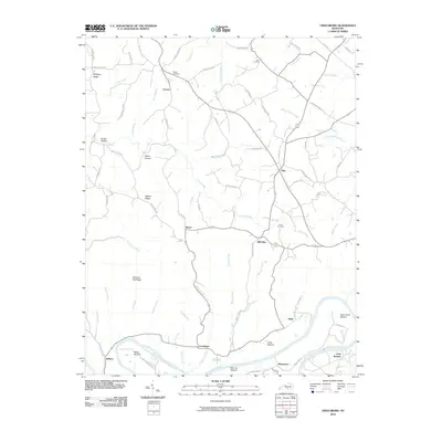
2010 Map of Creelsboro
USGS Topo · Published 2010About this map
Cumberland River bends sharply through the southern reaches of this landscape, defining the fertile lowlands of Wells Bottom, Salt Lick Bottom, and Long Bottom. The settlement of Creelsboro sits just north of the river, serving as a focal point for a network of rural roads that connect smaller communities like Ribbon and Manntown. The terrain is characterized by high ridges such as Chestnut Flat Ridge and Simpson Ridge, which are dissected by numerous waterways including Crocus Creek and Millers Creek. This 2010 survey documents a resilient rural structure where family and community landmarks remain central. Genealogists and local historians can locate the Ragen Cemetery near Crocus or the Dixon Cemetery situated between Olga and Old Olga. The map tracks the winding paths of several branches and forks, such as Glens Fork and Liberty Creek, illustrating the complex drainage system feeding into the primary river valley.
Find a feature on this map
77 named features on this map. Tap any name to fly to it.
Don’t see what you’re looking for? This feature index may not catch every label — zoom into the map to look around manually.
Map Details
Editions of this 2010 Creelsboro Map
This is the sole edition of this map. No revisions or reprints were ever made.
Other maps of this area

1953 · Amandaville
USGS Topo · 1:24,000

1953 · Montpelier
USGS Topo · 1:24,000

1953 · Burkesville
USGS Topo · 1:24,000

1953 · Wolf Creek Dam
USGS Topo · 1:24,000

1953 · Creelsboro
USGS Topo · 1:24,000

1953 · Jamestown
USGS Topo · 1:24,000

1954 · Cumberland City
USGS Topo · 1:24,000

1954 · Columbia
USGS Topo · 1:24,000

1954 · Russell Springs
USGS Topo · 1:24,000

1956 · Corbin
USGS Topo · 1:250,000