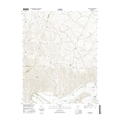
2016 Map of Creelsboro
USGS Topo · Published 2016About this map
Creelsboro and the winding course of the Cumberland River anchor this mid-2010s survey of southern Kentucky. The landscape is defined by the sharp transition between high ridges and fertile river flats, notably at Salt Lick Bottom and Long Bottom. A significant natural landmark, the Rock House Natural Bridge, stands near the riverbank at the southern edge of the quadrangle.
Find a feature on this map
93 named features on this map. Tap any name to fly to it.
Don’t see what you’re looking for? This feature index may not catch every label — zoom into the map to look around manually.
Map Details
Editions of this 2016 Creelsboro Map
This is the sole edition of this map. No revisions or reprints were ever made.
Other maps of this area

1953 · Amandaville
USGS Topo · 1:24,000

1953 · Montpelier
USGS Topo · 1:24,000

1953 · Burkesville
USGS Topo · 1:24,000

1953 · Wolf Creek Dam
USGS Topo · 1:24,000

1953 · Creelsboro
USGS Topo · 1:24,000

1953 · Jamestown
USGS Topo · 1:24,000

1954 · Cumberland City
USGS Topo · 1:24,000

1954 · Columbia
USGS Topo · 1:24,000

1954 · Russell Springs
USGS Topo · 1:24,000

1956 · Corbin
USGS Topo · 1:250,000