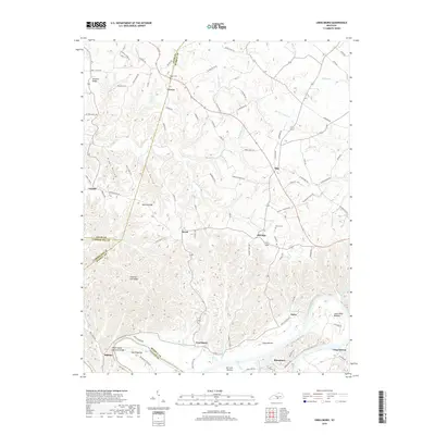
2019 Map of Creelsboro
USGS Topo · Published 2019About this map
The Cumberland River carves a deep, winding path through this southern Kentucky landscape, defining the borders between Russell, Cumberland, and Clinton counties. Fertile river valleys such as Wells Bottom, Long Bottom, and Salt Lick Bottom contrast with the elevated terrain of Simpson Ridge and Chestnut Flat Ridge. The settlement of Creelsboro serves as a central point in this rural network, connected to outlying communities like Old Olga, Helm, and Manntown by a web of local roads. Near the river, the Rock House Natural Bridge stands as a prominent geological landmark. Genealogists may find interest in the documented locations of Ragen Cem and Dixon Cem, while researchers of local history can trace the many small branches and creeks, such as Crocus Cr and Mud Lick Cr, that fed the agricultural life of the area.
Find a feature on this map
106 named features on this map. Tap any name to fly to it.
Don’t see what you’re looking for? This feature index may not catch every label — zoom into the map to look around manually.
Map Details
Editions of this 2019 Creelsboro Map
This is the sole edition of this map. No revisions or reprints were ever made.
Other maps of this area

1953 · Amandaville
USGS Topo · 1:24,000

1953 · Montpelier
USGS Topo · 1:24,000

1953 · Burkesville
USGS Topo · 1:24,000

1953 · Wolf Creek Dam
USGS Topo · 1:24,000

1953 · Creelsboro
USGS Topo · 1:24,000

1953 · Jamestown
USGS Topo · 1:24,000

1954 · Cumberland City
USGS Topo · 1:24,000

1954 · Columbia
USGS Topo · 1:24,000

1954 · Russell Springs
USGS Topo · 1:24,000

1956 · Corbin
USGS Topo · 1:250,000