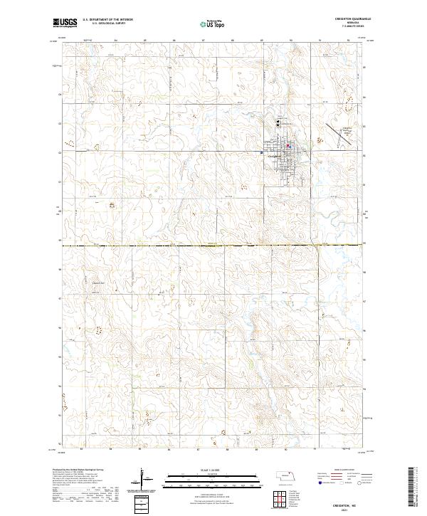
2021 Map of Creighton
USGS Topo · Published 2021About this map
Creighton serves as the primary hub of this landscape, its residential grid defined by streets such as Main St, State St, and Emerson St. Located in the northeast corner of Knox County, the town is supported by the Creighton Municipal Airport to the east. The surrounding agricultural terrain is divided by a systematic network of section roads like 873 Rd and 870 Rd, tracing the high ground between local waterways. Bazile Creek meanders through the southern half of the map, while Merriman Creek and Spring Creek drain the western and northeastern reaches. Genealogy interests are found at Saint Ludgers Cem and Greenwood Cem, which sit just north of the city limits near the locally significant Council Hill.
Find a feature on this map
35 named features on this map. Tap any name to fly to it.
Don’t see what you’re looking for? This feature index may not catch every label — zoom into the map to look around manually.
Map Details
Editions of this 2021 Creighton Map
This is the sole edition of this map. No revisions or reprints were ever made.
Other maps of this area

1954 · Verdigre
USGS Topo · 1:24,000

1955 · Sioux City
USGS Topo · 1:250,000

1955 · O'Neill
USGS Topo · 1:250,000

1958 · Sioux City
USGS Topo · 1:250,000

1959 · O'Neill
USGS Topo · 1:250,000

1959 · Sioux City
USGS Topo · 1:250,000

1963 · Orchard NE
USGS Topo · 1:24,000

1963 · Plainview
USGS Topo · 1:24,000

1963 · Brunswick
USGS Topo · 1:24,000

1963 · Royal
USGS Topo · 1:24,000