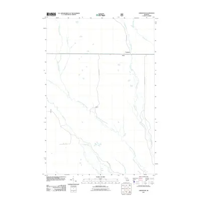
2011 Map of Creighton
USGS Topo · Published 2011About this map
Creighton and the nearby settlement of Pines occupy a landscape defined by an extensive network of waterways in the Upper Peninsula. The West Branch Manistique River winds across the central terrain, serving as the primary drainage for numerous tributaries including Commencement Creek, Pine Creek, and Hickey Creek. This area illustrates the specialized road networks of Michigan's timber and recreational lands, where routes like Hartman Camp Rd and the Hickey Creek Truck Trl provide access to remote locations such as Hartman Camp. The map details the junction of the Creighton River and Marsh Creek in the northeast, highlighting a complex riparian system. The presence of named truck trails and camps alongside established routes like County Hwy 454 suggests a region historically tied to forest management and seasonal habitation within Schoolcraft County.
Find a feature on this map
15 named features on this map. Tap any name to fly to it.
Don’t see what you’re looking for? This feature index may not catch every label — zoom into the map to look around manually.
Map Details
Editions of this 2011 Creighton Map
This is the sole edition of this map. No revisions or reprints were ever made.
Other maps of this area

1931 · Steuben NE
USGS Topo · 1:31,680

1931 · Shingleton SW
USGS Topo · 1:31,680

1931 · Steuben NW
USGS Topo · 1:31,680

1931 · Manistique River NW
USGS Topo · 1:31,680

1931 · Shingleton NE
USGS Topo · 1:31,680

1931 · Driggs Lake NW
USGS Topo · 1:31,680

1931 · Shingleton SE
USGS Topo · 1:31,680

1931 · Driggs Lake SW
USGS Topo · 1:31,680

1958 · Shingleton
USGS Topo · 1:62,500
1958 · Steuben
USGS Topo · 1:62,500