
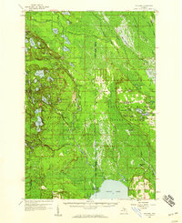
1931 Map of Manistique River NW
USGS Topo · Published 1931About this map
West Branch Manistique River winds through a vast, uninhabited wetland landscape in the Upper Peninsula, as recorded during a 1931 survey by the Michigan Department of Conservation and the USGS. This particular sheet represents an advance copy compiled in part from aerial photographs taken by the U.S. Army Air Corps, reflecting the evolution of mapping technology in the early 20th century. The terrain is defined by its drainage network, with the Creighton River and Hickey Creek feeding into the main channel.
Find a feature on this map
6 named features on this map. Tap any name to fly to it.
Don’t see what you’re looking for? This feature index may not catch every label — zoom into the map to look around manually.
Map Details
Editions of this 1931 Manistique River NW Map
This is the sole edition of this map. No revisions or reprints were ever made.
Other maps of this area

1931 · Steuben SE
USGS Topo · 1:31,680

1931 · Manistique River NE
USGS Topo · 1:31,680

1931 · Steuben NE
USGS Topo · 1:31,680

1931 · Manistique River SE
USGS Topo · 1:31,680

1931 · Shingleton SE
USGS Topo · 1:31,680

1931 · Manistique River SW
USGS Topo · 1:31,680

1931 · Driggs Lake SW
USGS Topo · 1:31,680

1931 · Driggs Lake SE
USGS Topo · 1:31,680

1958 · Shingleton
USGS Topo · 1:62,500
1958 · Steuben
USGS Topo · 1:62,500