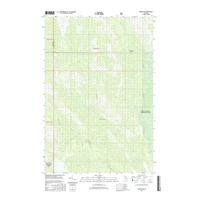
2017 Map of Creighton
USGS Topo · Published 2017About this map
Creighton River and the W Br Manistique River define the intricate drainage of this Schoolcraft County landscape. Centered on the settlement of Creighton, the area is characterized by the expansive Creighton Marsh and the protected lands of the Seney National Wildlife Refuge. The passage of M-28 provides the primary east-west corridor, while a network of service roads and trails like the Hickey Creek Truck Trl and Creighton Truck Trl penetrate the timberlands. To the southwest, the map includes a portion of the Hiawatha National Forest, illustrating the importance of federal conservation and forest management in Michigan's Upper Peninsula. The numerous smaller tributaries, such as Section Nineteen Cr and Marsh Cr, indicate a complex wetland environment critical to the local ecology.
Find a feature on this map
23 named features on this map. Tap any name to fly to it.
Don’t see what you’re looking for? This feature index may not catch every label — zoom into the map to look around manually.
Map Details
Editions of this 2017 Creighton Map
This is the sole edition of this map. No revisions or reprints were ever made.
Other maps of this area

1931 · Steuben NE
USGS Topo · 1:31,680

1931 · Shingleton SW
USGS Topo · 1:31,680

1931 · Steuben NW
USGS Topo · 1:31,680

1931 · Manistique River NW
USGS Topo · 1:31,680

1931 · Shingleton NE
USGS Topo · 1:31,680

1931 · Driggs Lake NW
USGS Topo · 1:31,680

1931 · Shingleton SE
USGS Topo · 1:31,680

1931 · Driggs Lake SW
USGS Topo · 1:31,680

1958 · Shingleton
USGS Topo · 1:62,500
1958 · Steuben
USGS Topo · 1:62,500