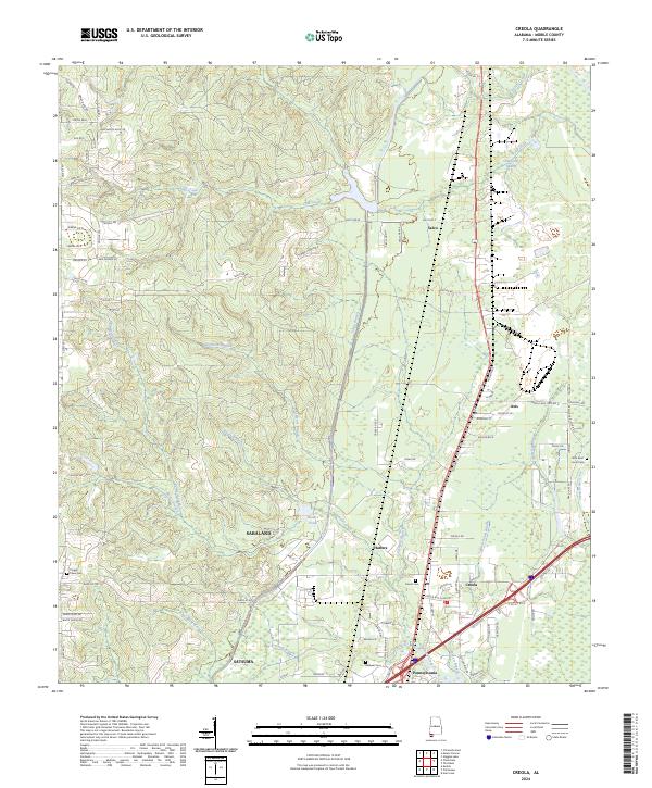
2024 Map of Creola
USGS Topo · Published 2024About this map
Creola and the neighboring settlements of Axis and Salco anchor this survey of the landscape north of Mobile. The map reveals a transition from the dense residential developments of Satsuma and Saraland in the south toward the expansive wetlands of Gold Creek Swamp and the drainage basins of Gunnison Creek. The presence of several family and community burial grounds, such as Creola Cem and Baldwin Cem, provides a valuable resource for genealogists tracing the established roots of these Mobile County communities. The intricate network of local waterways, including Turtle Branch and Sipau Branch, defines the low-lying terrain, while Hatters Pond serves as a prominent landmark near the community of Hatters. This contemporary view of the region highlights the persistent role of the rail corridor and major thoroughfares in shaping the settlement patterns of these coastal plain towns.
Find a feature on this map
91 named features on this map. Tap any name to fly to it.
Don’t see what you’re looking for? This feature index may not catch every label — zoom into the map to look around manually.
Map Details
Editions of this 2024 Creola Map
This is the sole edition of this map. No revisions or reprints were ever made.
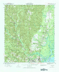
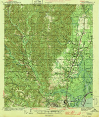
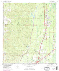
Historical Maps of Axis Through Time
4 maps found